East Texas Braces for Hurricane Laura, Reminiscent of Rita in ’05
September 24, 2005.
Hurricane Rita made landfall near Sabine Pass as a Category 3 Hurricane with top sustained winds of 120 mph. The storm's center tracked inland over Jasper, Tyler, San Augustine, and Shelby Counties. Hurricane-force winds caused numerous trees to topple and their were widespread long-term power outages in Lufkin, Nacogdoches, and all across the Pineywoods.
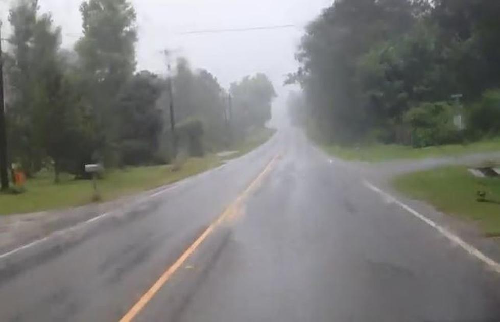
Hurricane Laura could pass for Rita's younger sister, that is if the forecasters are right about her. As of Tuesday morning, what is now Tropical Storm Laura is expected to intensify to a Category 3 Hurricane at landfall. According to the National Hurricane Center Sabine Pass is in the bullseye for Laura. The inland track of the storm should take it northerly hugging the Texas/Louisiana border. Widespread damage and power outages are expected in our area as tropical storm to hurricane force winds move in.
Mandatory evacuations have been ordered to residents of Jefferson and Orange Counties. That order affects some 330,000 residents. A storm surge in that area of up to 11 feet is expected. Crystal Beach could see a storm surge of 6 feet or higher. We can expect to see an increase of traffic on highways outbound from the southeast Texas area. So, be ready for the possibility of congested roadways on Highways 69, 59, 96, and 87 among others.
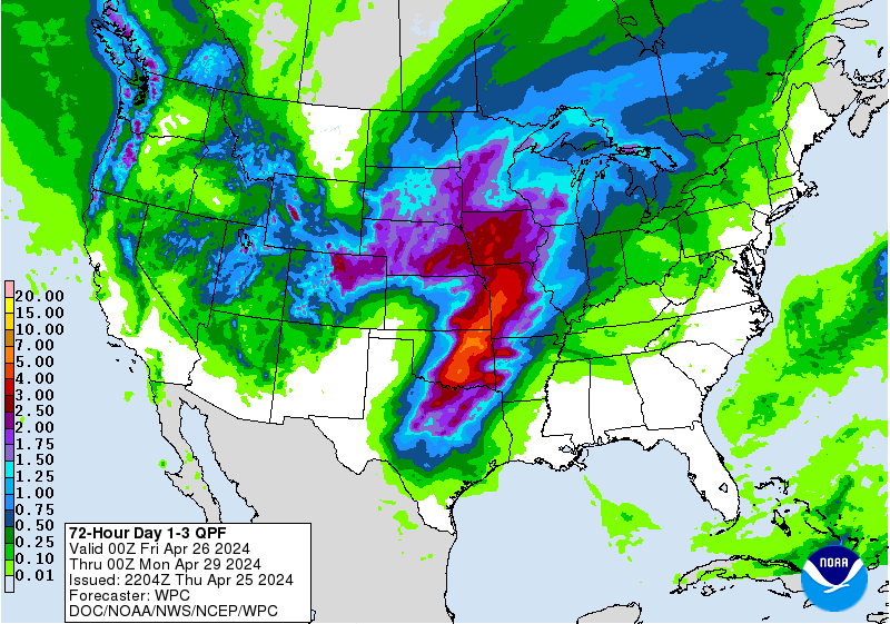
Due to the fast moving track of the storm, massive rainfall amounts shouldn't be too much of a concern. Currently, forecast models show about 2-5 inches of rain falling across Deep East Texas with heavier amounts closer to Toledo Bend and into Louisiana.
The predicted track of Laura has varied greatly over the past week, so please listen to KICKS 105 or download our App to keep up with the latest forecast. Hunker down and stay safe.

More From K-Fox 95.5